Fuerteventura is a subtropical island belonging to the Canary archipelago.
After Tenerife it is the largest island of the archipelago.
From a geological point of view, Fuerteventura is considered the oldest island of the Canaries; formed from underwater volcanic eruptions, the last of which occurred about 5,000 years ago.
From the first eruption on the island, the landscape that today characterizes Fuerteventura in its uniqueness was formed.
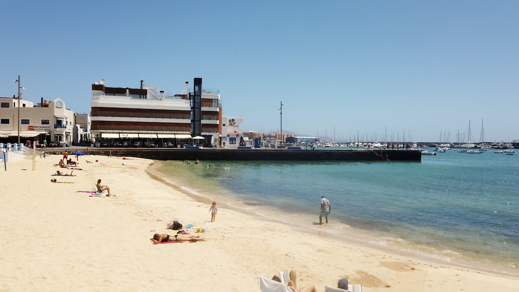
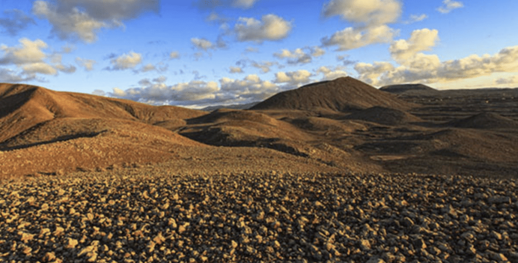
However Fuerteventura has different landscapes, with wide plains, 152 beaches along 362 km of coastline with fine white sand or volcanic gravel and volcanic reliefs.
The volcanic reliefs on the island are:
- Calderón Hondo
- The alignment of the Bayuyo
- Montaña sagrada de Tindaya
- Montaña Caima
- Natural Monument of the Caldera de Gairía
Calderón Hondo:
General appearance:
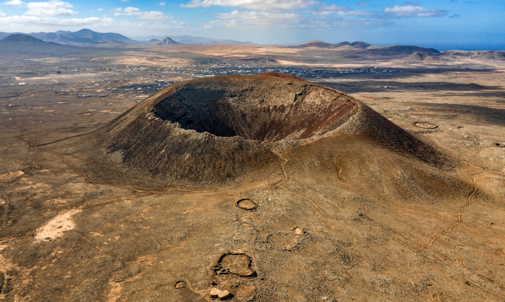
El Calderón Hondo is located in the municipality of La Oliva, north of the village of Los Lajares.
This volcano has a reform crater and a reddish substrate, considered recent, about 50,000 years old.
Calderón Hondo and Colored Mountain are both part of a volcanic alignment whose activity greatly increases the area of Fuerteventura to the north.
This volcanic elevation offers a fantastic views of the north of Fuerteventura and the south of Lanzarote.
The highest point on the edge of the crater reaches a height of 278m, while the lowest point of the crater is at 162m high.
The circle is at the lowest point of a height of 227 m. being the depth of the crater at least 66 m and reaching up to more than 70 m, it is the edge of the crater, where we can find particles of sulfur perfectly visible due to its yellow color.
The Alineación del Bayuyo:
General appearance:
The Bayuyo alignment is a collection of volcanic cones that erupted around the same time, following an almost straight line.
These volcanoes have a circular plan and hot reform craters, ranging from Lobos Island to Colored Mountain, and are formed by the following volcanic craters:
Bayuyo, Las Calderas, Caldera Encantada, Caldera Rebanada, Calderón Hondo, Montaña Colorada, Channel Mountain and Lomo Bianco Mountain, which together with their bad villages form one of the most spectacular landscapes in the north of Fuerteventura.
With a difference in height of over 160 meters, from the base of the cone to the top, and that of San Rafael with a height from the base of 190 meters, they are the two most bulky and visible volcanic buildings.
It also has a marked path from which you can see the inside of the crater.
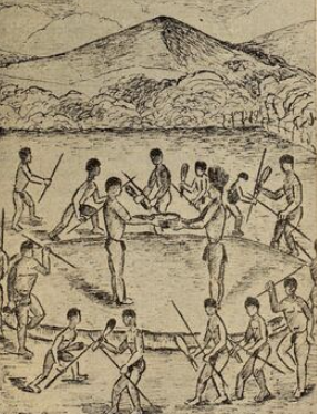
In this area there are remains of the pre-Hispanic past of the island, with small groups of circular buildings made of dry stone, of small dimensions, and of which a part is used as a dwelling and another is dedicated to the cattle pen.
Origin of the name:
In addition to the geological beauty of the volcano, the alignment of the Bayuyo has a particular meaning, handed down for years, concerning its name:
The word Bayuyo is reported in the provisional catalog of Guanches terms present in the Canarian toponymy as one of the pre-Hispanic words.
Bayuyo (bajiwəgjiwəg) in the Amazigh language, has a spiritual sense, and could be transcribed as enchanted clouds or floating objects.
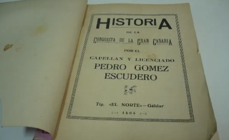
Bayuyo are also the enchantments or spirits that arrive from the sea in the shape of clouds when the door of the summer solstice opens, this phenomenon was described by the 15th century chronicler Pedro Gómez Escudero, in the populations of Lanzarote and Fuerteventura.
There are still reviews, in popular tales and legends of Fuerteventura, of supernatural experiences of places where souls, spirits and divinities live, and interact with all those who walk in these places.
Montaña sagrada de Tindaya:
General appearance:
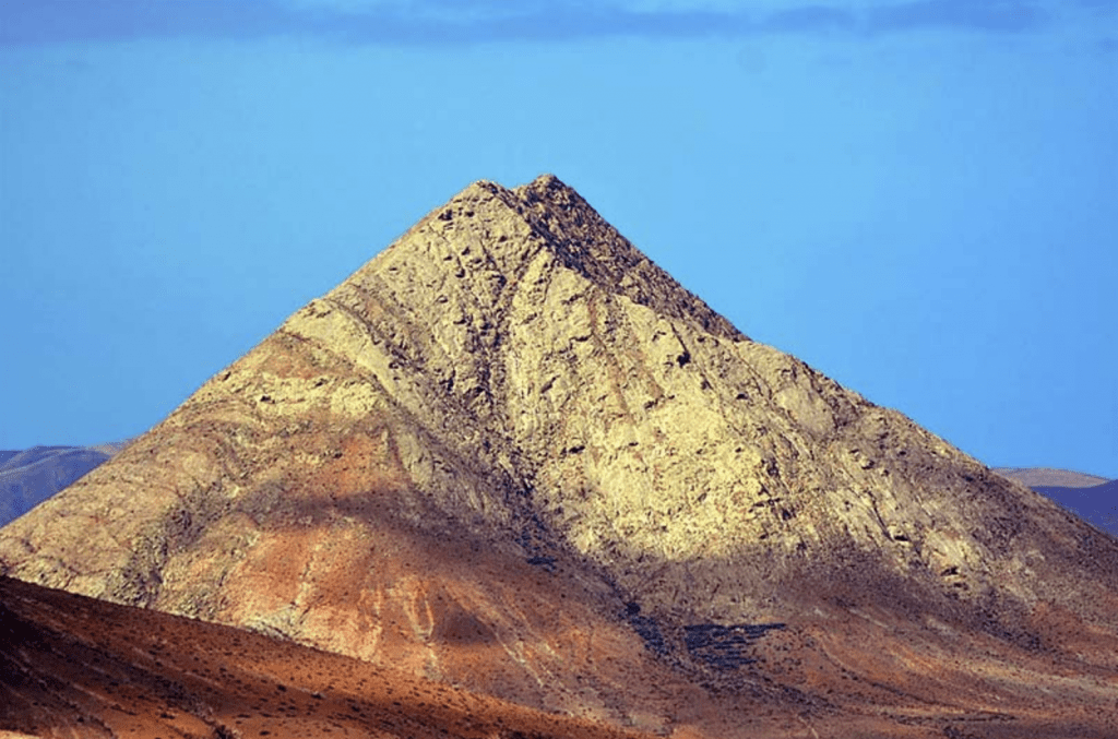
Mount Tindaya is a light brown-gray volcano and a particular element, trachyte, a rock of red marble.
La Montaña de Tindaya looks very different from that of most of the other volcanoes in Fuerteventura which are of the Strombolian type.
Due to its geological value, the Montaña de Tindaya was classified as a nature reserve in 1987 and 1994 as a natural monument and geological point of interest.
Origin of civilizations:
The uniqueness of Tindaya probably captured the imagination of the aborigines of Fuerteventura who made Tindaya a sacred mountain (Montaña sagrada de Tindaya).
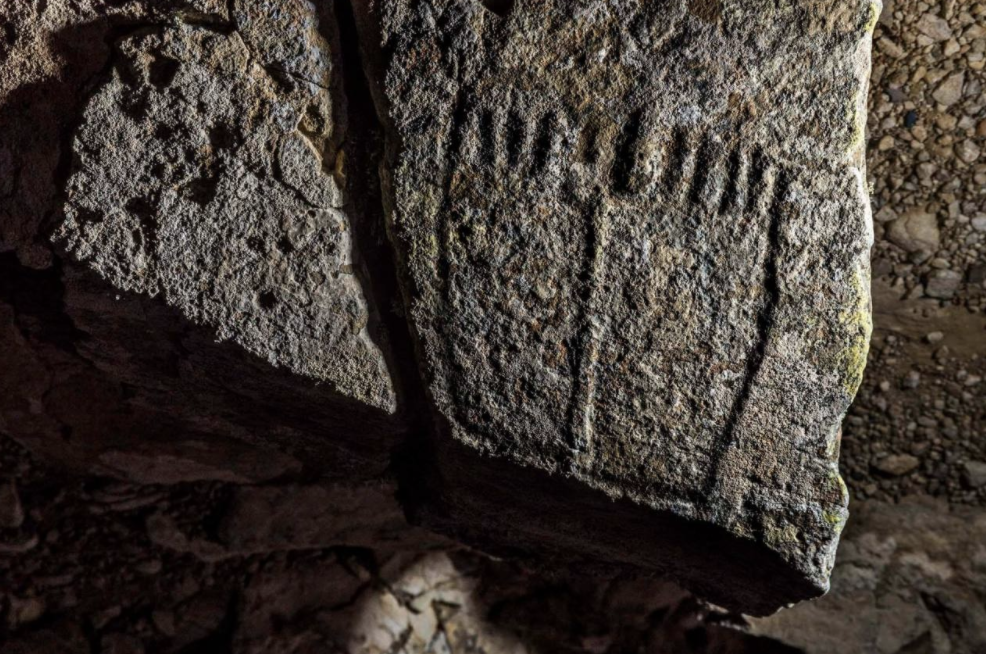
In fact, near the top of the mountain there are many petroglyphs with shapes of human feet (podomorphic petroglyphs):
about 290 of these are almost all oriented towards the west (the summit of Teide on Tenerife) or towards the south-west (the island of Gran Canaria).
These carvings suggest a Berber origin of Canarian aborigines.
In addition to the engravings, other archaeological remains have been found such as cave houses, a necropolis and a shell drain.
The upper part of the Tindaya appears to have been a place of worship where human sacrifices took place.
Montaña Caima:
General appearance:
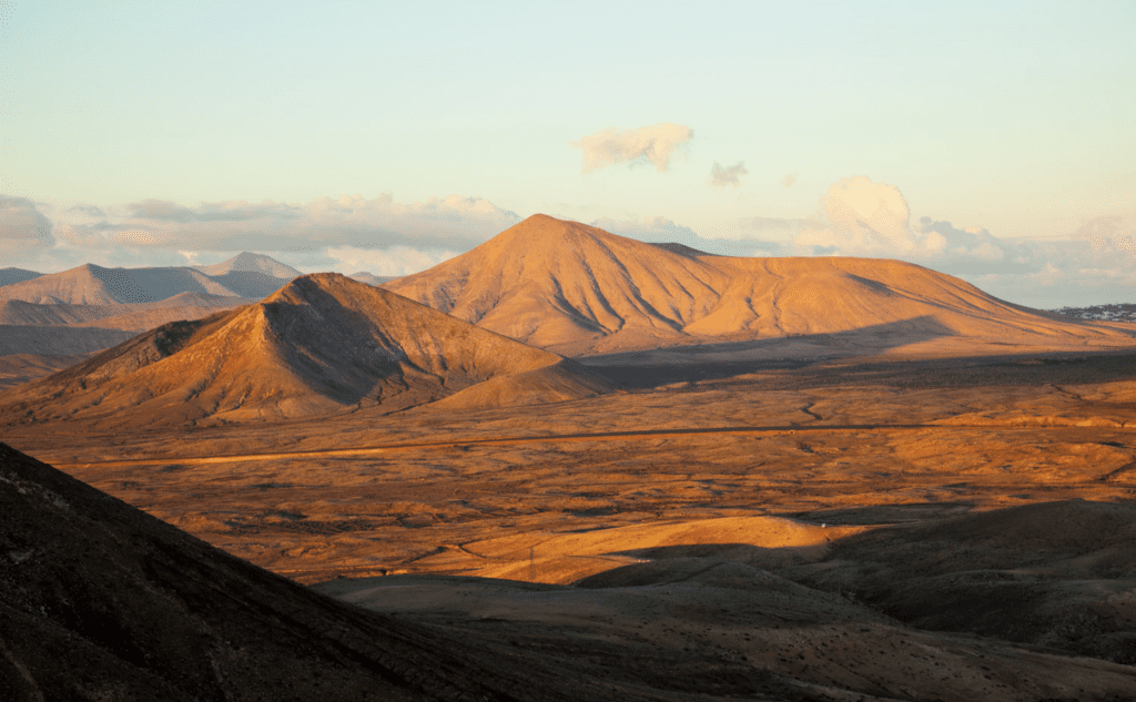
In the municipality of Oliva, near the village of Villaverde, there is the Montagna Caima, an asymmetrical volcanic cone with little more than a million years old.
Caima Mountain lines up with other volcanic cones, forming a flat landscape.
On the north-east side there is a large horseshoe-shaped crater, while the south-west side is the most spectacular to photograph.
There the lava tongues are found covered with sandy-clayey deposits partially filled with volcanic ash, forming a unique landscape.
The surroundings of Mountain Caima have little vegetation, in addition to the aulagas, and the fauna of is not very varied.
Inside the mammals it is easy to find squirrels, rabbits, hedgehogs, and Canary shrews.
While the flaps are the most representative reptiles of this area.
Origin of civilizations:
Since the pre-Hispanic era, the surroundings of Mountain Caima have been chosen by the "maho" to be inhabited.
On the northwest side of the mountain is the Peña Erguida Rose Cave, which was used by the mahos before the arrival of the castellans on the island.
In the surroundings you can see today the remains of malacofauna and small ceramic pieces of aboriginal workmanship.
In the area between Mountain Caima and Mountain Pajarita, there is a large undergrowth with planted plants.
In this environment is another of the natural caves used by the mahos, which had two living rooms where abundant ceramic remains were found.
After the Castilian conquest and colonization, the Llano de Caima remained an important area, both for the cultivation of cereals and for the grazing of goats.
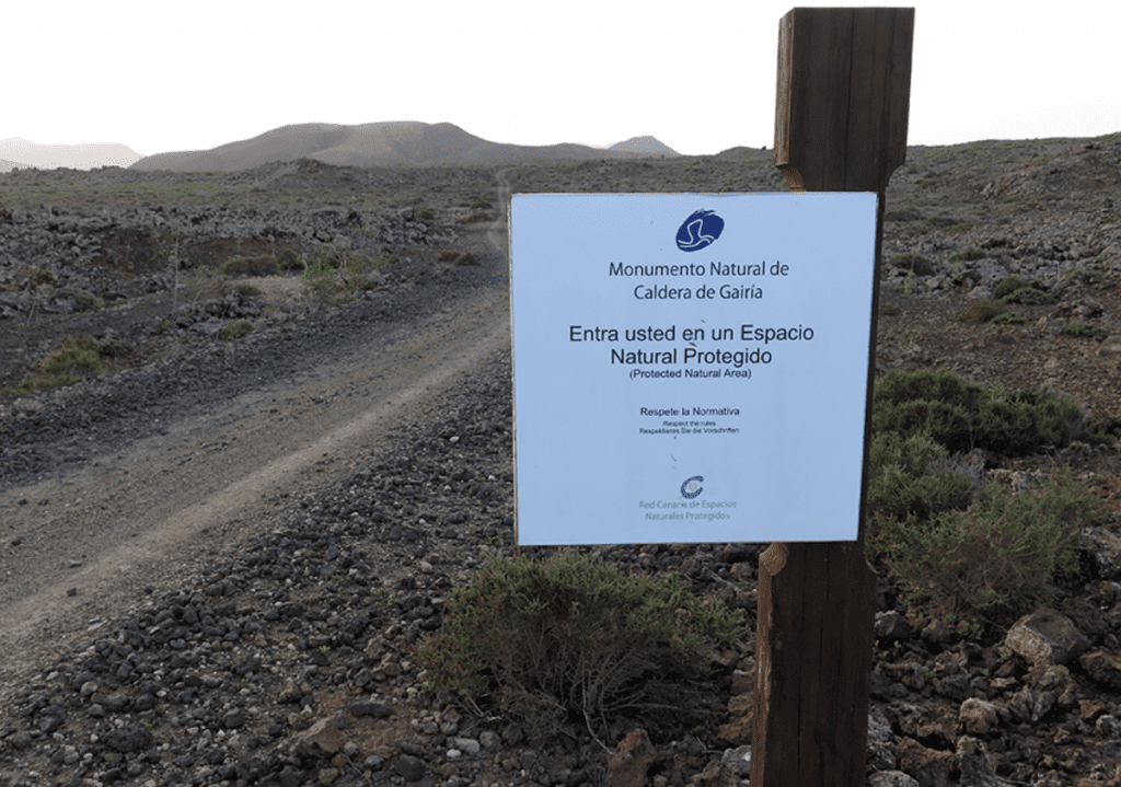
Natural Monument of the Caldera de Gairía:
General appearance:
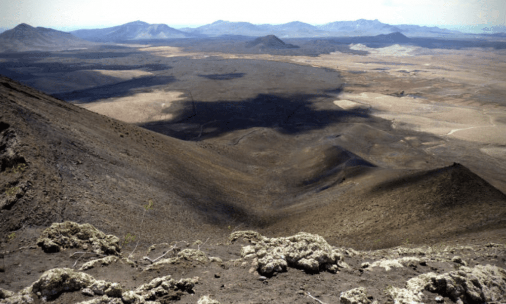
The Caldera de Gairía Natural Monument is part of the Agua de Bueyes catchment area and is located in the municipalities of Antigua and Tuineje.
It has a good state of conservation, presenting a great landscape, geological and geomorphological interest.
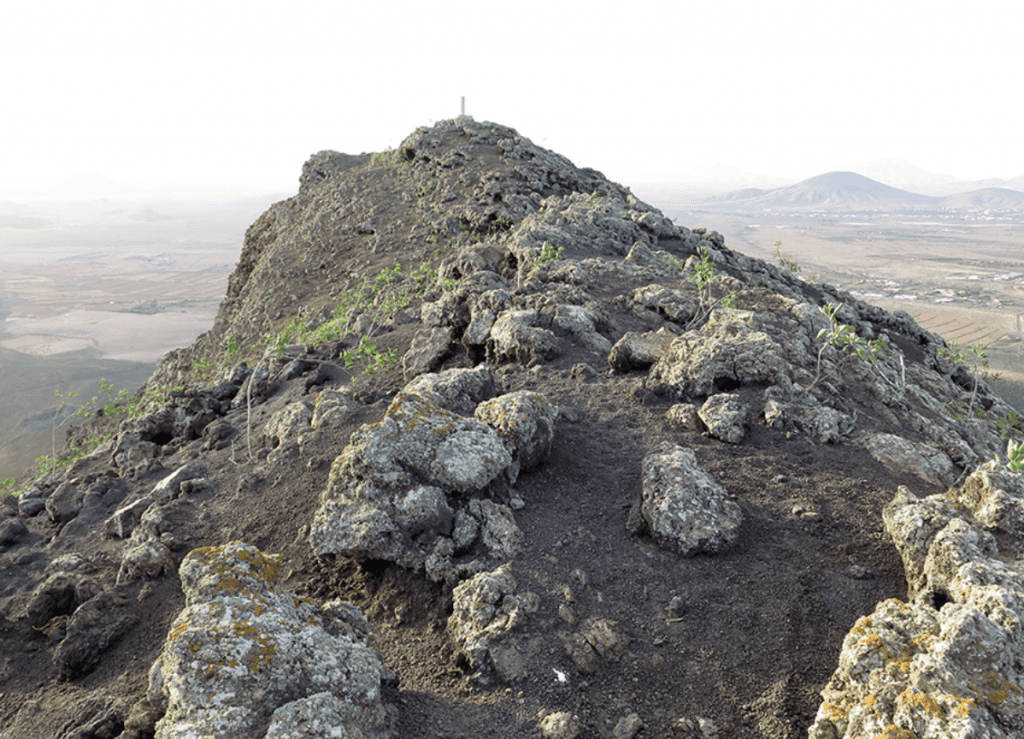
The Caldera de Gairía is the largest of the four and stands out for its height, 461 meters, in a rather flat area.
The cone itself constitutes a cornerstone of the landscape and is visible from many points.
In the Caldera de Gairía very few areas have been used for cultivation because the soils are not very productive, of poor fertility, arid and stony, but it has been and remains a grazing area.
There is a dirt track, known as Camino de los Areneros, which crosses Space and which is used a lot by visitors who come to discover this fantastic place. Access to the peak of Gairía is difficult and therefore not very popular.
A particular vegetation develops on the volcano which is protected by the Habitat directive;
there are "tabaibal dulce", in particular to the south-east of the volcano, and the "tabaibal amaro", to the east of the volcano is
Furthermore, the arid nitro bush, which includes the algohuera, the hawthorn, the branch and the aulaga, is very common within the Natural Monument.
Among the fauna, the diurnal birds of prey stand out and in particular the common alimoche or guirre, which has breeding areas on the banks of the Caldera de Gairía.
The representation of steppe birds, very characteristic of Fuerteventura, is much poorer than in other areas of the island.
Laws for Safeguarding:
The Caldera de Gairía was declared with the law 12/1987 of June 19, of Declaration of Natural Areas of the Canary Islands as a Natural Site of National Interest.
It was subsequently reclassified from Ley 12/1994 de 19 de diciembre, de Espacios Naturales de Canarias as a Natural Monument; a figure that continues to be maintained in the Legislative Decree 1/2000, of 8 May, which approves the consolidated text of the planning laws of the Canaries and the natural spaces of the Canaries.
Trekking on volcanoes in Fuerteventura:
Thanks to the presence of volcanoes within the island of Fuerteventura, the tourism that arouses them makes available routes to be carried out on foot or by bicycle for lovers of discovery and nature:
Trekking Calderón Hondo:
The route to reach Calderón Hondo is very simple.
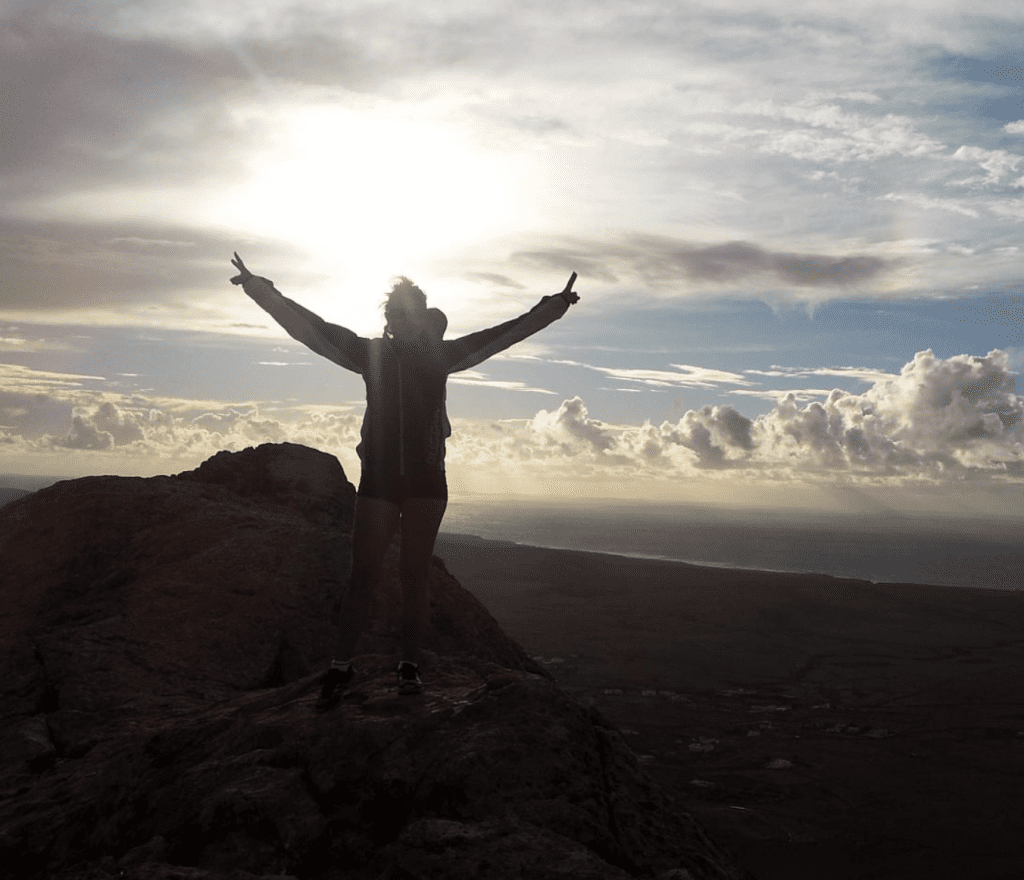
Once you reach the summit, which in its simplicity of the route can also be done by children, you will be able to admire a suggestive landscape so as to be able to see the island of Lanzarote and that of Lobos.
The route has an easily traversable terrain, with the exception of some sections where there are pebbles which, with the high temperatures, make the journey more tiring.
Which path to take?
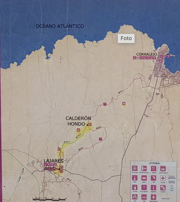
There are different paths that lead to the volcano and which, in the same way, start from different places.
The most common is the one starting from the nearby town of “Lajares”; here you can see a parking lot with the various indications that will lead to the second town of “Majanicho”.
Once the car is parked, it will be necessary to continue on foot to the foot of the volcano.
The path is clear and well traced, there are two equally accessible paths that will lead to the summit.
The left path is the steepest but also the fastest one, while the right one follows a circular path and is longer but much simpler.
As already mentioned, the path to reach Calderon Hondo is not difficult but can involve dangers if done with little preparation:
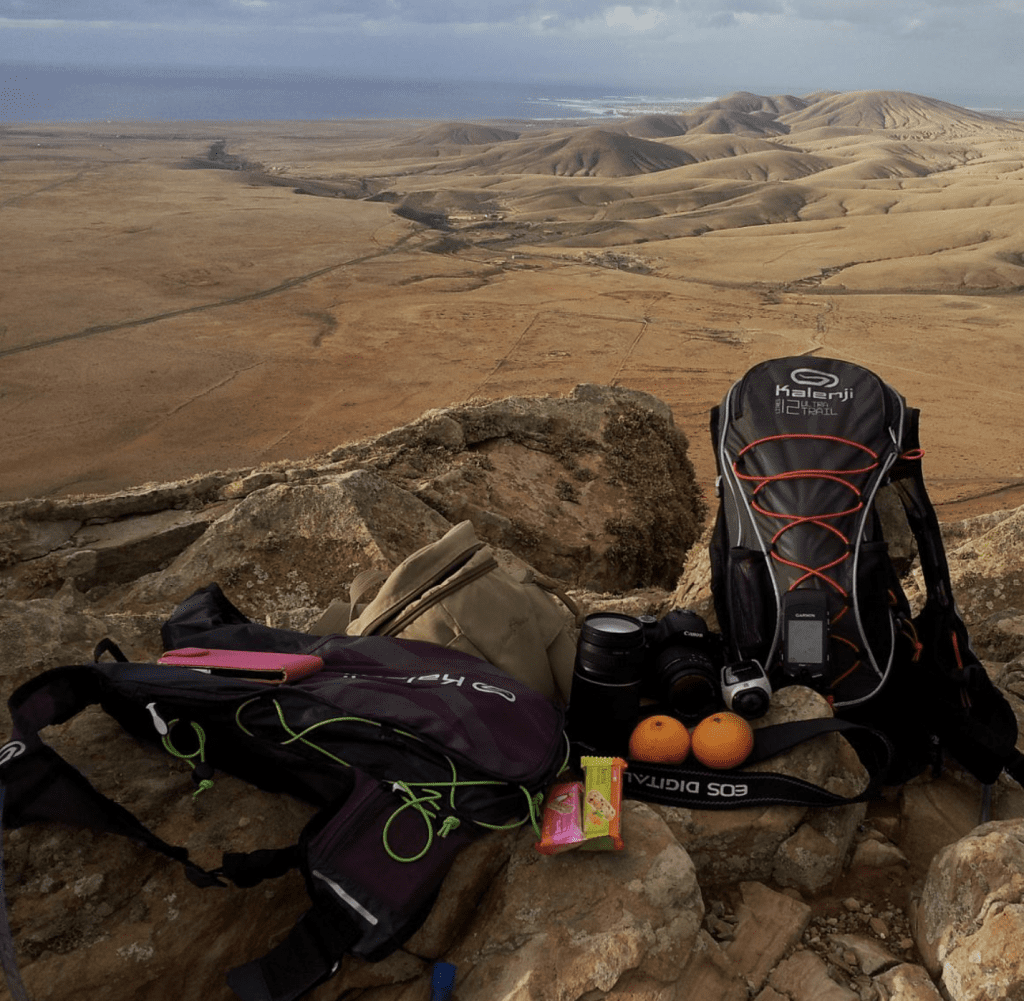
It is necessary to leave prepared with what you need.
The ground is in good condition but often there are lava stones which in some cases can be pointed.
It is also advisable to pay attention, once you get to the top, to gusts of wind.
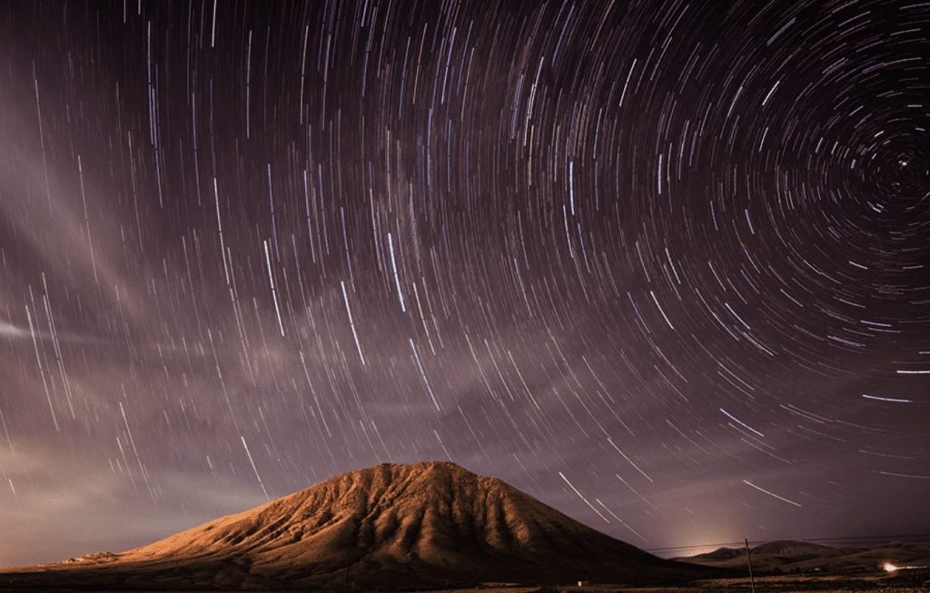
The Calderon Hondo is also one of the best places to see the sunset in Fuerteventura, if you decide to do this trek to see the sunset you have to calculate well the times of the return and bring torches with you as the path is completely in the dark.
What do you need to hike to Calderón Hondo?
Essential are comfortable clothing, such as technical T-shirts that can dry easily, and adequate footwear.
Obviously for this type of excursion it is recommended to bring sunscreen to be applied several times, a hat, snacks and lots of fresh water.
Trekking Montaña sagrada de Tindaya:
To reach the Montaña Sagrada de Tindaya there is a special path that is not too difficult.
Before embarking on the route it is highly recommended, especially with an open mind, so as to better appreciate the magical landscape of Tindaya.
Which path to take?
To the south-west of Tindaya there is a path that allows you to get to know the sacred mountain up close and to appreciate the beauty of its colors, in fact the whole landscape that surrounds it is full of tranquility and mystery.
At its foot, south of the mountain, there is a small village where you can find some shops and restaurants that make visiting this magical enclave more convenient.
What do you need for Trekking Montaña sagrada de Tindaya?
You won't need anything other than a trek to Calderón Hondo to complete the route.
Comfortable clothing and shoes, sunscreen and a hat are recommended; no less a snack and some fresh water.
Trekking in Monumento Natural de la Caldera de Gairía:
The Monumento Natural de la Caldera de Gairía has paths to follow if you want to reach its summit and later admire the characteristic landscape it presents.
It has an extension of 240 hectares, and it is possible to climb to its top of 461 meters high, from where you can observe other recent volcanic formations, such as the Malpaís Grande, and other volcanic buildings, such as the Caldera de la Laguna, exploited until a few years ago as a pigeon producer (a small volcanic stone used in gardens and parks in the Canary Islands as a "moisture collector" of the atmosphere).
Which path to take?
The volcano of Gairia is located at the foot of the town of Tiscamanita, and is located 10 kilometers from Antigua and 4 from Tuineje, which connects the capital with Gran Tarajal.
From Tiscamanita you can do several hiking trails for the area:
from the ascent to the Caldera de Gairia, to the visit of other recent volcanic buildings in the surroundings: Caldera de la Laguna, Caldera de los Arrabales, Caldera de la Laguna, Liria boiler, or other protected area that borders on this: the Malpaís Grande.
In the area there are also camels that graze freely and the typical herds of Fuerteventura goats, the symbol of the island.
What do you need for Trekking Monumento Natural de la Caldera de Gairía?
To complete the route you will not need anything different from the previous treks.
It is always recommended to wear comfortable clothing and shoes, a sunscreen and a hat; no less a snack and some fresh water.
If you want more information about the volcanoes and the available itineraries, the Cofete Coworking staff will respond to your requests.